
Manga Fm
Type Locality and Naming
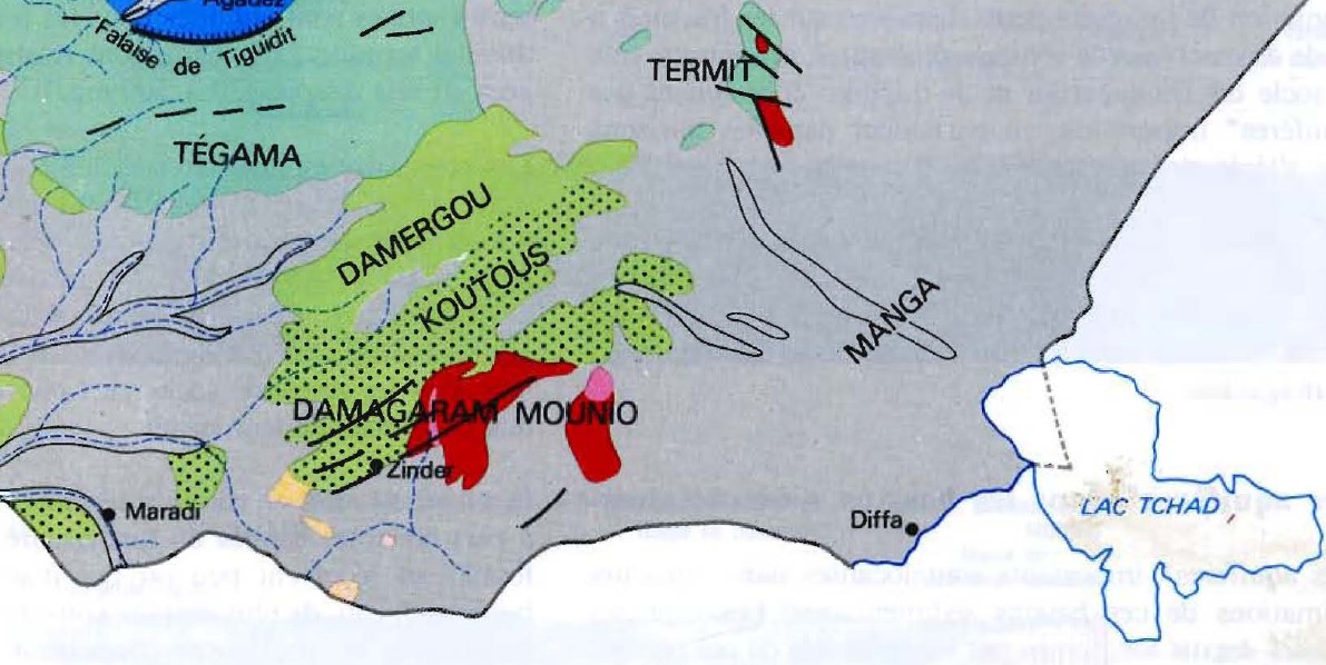
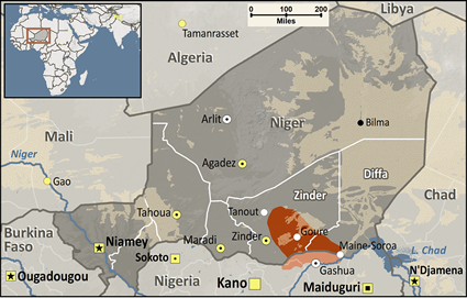
The Niger-Chadian Manga is an area extending northwest of Lake Chad (Fig. 1). A dune field forms it with relatively high altitudes reaching 350 to 360 m. The interdunes are at altitudes varying between 275 and 315 m. The ethnic group of Manga is located between Zinder and Lake Chad (See Figure 2).
[Figure 1. Location of Manga northwest of Lake Chad (Bernus et al., 1980).]
[Figure 2. Location of the ethnic group of Manga https://joshuaproject.net/people_groups/13496/NG . See Fig. 1 for the location of the Quaternary Manga Fm.]
References: Servant, 1973; Mathieu, 1978; Fabre et al., 1983; Saley, 2018.
Synonym: Formation interdunaire du Manga
Lithology and Thickness
Interdune deposits include one or two sequences corresponding to many lacustrine episodes. The succession is as follows:
- The Holocene lakes in this region dried up around 2,400 years BP.
- Disappearance of the surface water level.
- A second lacustrine episode (around 7,000 years BP?). The formation of diatomaceous sedimentation lakes (upper diatomaceous earth) in depressions favored by topographical and hydrogeological conditions allows the water table to come to the surface. Elsewhere, the sedimentation is sandy-calcareous;
- A regressive phase (around 7,500 years BP?). It provoked the drying up of the interdunes, the bottom of which proved favorable to the accumulation of iron. The corresponding deposits are clay sands with ferruginous nodules called “middle layers”;
- First lacustrine episode (10,000 - 9,000 years BP?). It resulted in the flooding of all the depressions regardless of their topographical position. It is represented by a diatomite (lower diatomite) resting on the Aeolian sands of the Manga region;
Relationships and Distribution
Lower contact
Upper contact
None
Regional extent
GeoJSON
Fossils
Age
Depositional setting
Lacustrine
Additional Information